Wednesday, June 12, 2013

High Sierra Hike, June 22


The trailheads for these 2 hikes are near the Tioga Pass entrance into Yosemite (the entrance that comes up from Highway 395).  From here in Modesto it will be a 3 hour drive and will cost $20 per carload to enter Yosemite at the Big Oak Flat entrance on Highway 120. Once in the park, we will not go into Yosemite Valley, but onto Tioga Pass Road.  If you've never been on this road, you're in for a treat even to skip the 2 hikes and to just wander around in Tuolumne Meadows. But for those who want some high country hikes, here are the 2 options I have for you on Saturday, June 22.


Option 1 (the one I will be doing)

Mono Pass, 7.8 miles round trip
This is one of my favorite hikes; I have day hiked and backpacked it too many times to count over the last 17 years, and it was where we took my son on his first backpack trip when he was 6.  My daughter has day hiked this since she was 5. 

Although it starts at a high elevation (9,700 ft), its 900 feet of elevation gain is spread over the 3.9 miles it takes to reach spectacular views of Mono Lake, so the hike isn't strenuous.  

The Mono Pass hike takes about 5-6 hours if you account for resting along the way and hanging out for awhile to enjoy the spectacular views.  


Looking over to Mono Lake, October 2012

Option 2 (I will NOT be along on this one)

Gaylor Lakes, 3 miles round trip
This hike starts with a steep climb, but rewards you with incredible views.  Once you've hiked up to the pass you will see the main Gaylor Lake, and once down there you can wander around to upper Gaylor and over to Granite Lake.  

My 6 year old and 10 year old did this hike with us last week - we just took it slow and rested a lot on the steep uphill.  Allow 3-5 hours for this hike to include resting and then exploring the lake area.  


Main Gaylor Lake with great views of the Sierras

Exploring the Gaylor Lakes basin

At such high elevations there is less oxygen to breath and the weather can change in a heartbeat. Following are some High Elevation hiking tips:
  • start out and stay well-hydrated
  • eat lots of carbs the day before and while hiking
  • hike slowly, rest often
  • bring along headache medicine
  • sunglasses and sunscreen are a must
  • long sleeves, pants, knit hats, gloves to protect from sun, wind, & cold
  • adjust breathing to slow, deliberate, and deep and keep it in rhythm with walking

As always, if you are already on the email list, you will get an email with specific trip meet-up details about a week before the hike. (Feel free to share the Blog link with others, but not the emails, as those are intended for those already signed up.)

If you are not signed up yet, you can sign up by going in to Modesto's incredible new outdoor gear shop, Jaunt Adventure Gear, 1508 10th Street, or feel free to send an email to Nicole at
jauntwithus@gmail.com


copyright Nicole Cipriano. All rights reserved.
Please do not copy or repost any content or photos.
Instead, please post the link to the Blog.


Sunday, May 12, 2013

June Hike Dates


Here are the June dates if you want to get them on your calendar!
SATURDAY JUNE 8th, 2 options at Pine Crest Lake:

Around the lake 4miles mostly flat
or
Cleo's Bath 5.2 miles, challenging, rock scrambling, swimming pools
to do this hike you should be over 5 yrs. old AND know how to swim


SATURDAY JUNE 22, 2 options off Tioga Pass Road (Yosemite):

Gaylor Lakes about 3 miles, short steep part, then astounding views
or 
Mono Pass 7.5 miles, fairly easy hike with incredible views of Mono Lake


October 2012

If you are already a part of Jaunt Adventure Group, you will get an email update with details as it gets closer.  
If you haven't joined Jaunt Adventure Group yet, send an email to 
Nicole at jauntwithus@gmail.com


copyright Nicole Cipriano. All rights reserved.
Please do not copy or repost any content or photos.
Instead, please post the link to the Blog.

Tuesday, May 7, 2013

Final Decision - Henry Cowell Redwoods State Park


Even though Yosemite plans to open Tioga Pass road this Saturday, I am afraid the trails are too muddy to really enjoy yet.  So we'll wait until June for Gaylor Lake and Mono Pass.  

THIS SATURDAY WE WILL HEAD TO THE FALL CREEK UNIT 
OF HENRY COWELL REDWOODS STATE PARK.  


I, your fearless and faithful guide, have not yet done the particular trail that I plan to lead you out on! I have been to other parts of this state park, and checked out the train ride and visitors center.  But the hike I want to check out this time is off the beaten path, not even through the regular fee entrance.  From what I can tell we just park and start walking, no fee entrance.  But let's all bring some cash just in case!

This trail has some neat history, and we will see old lime kilns.  If you go only as far as the lime kilns, it is a 2.5 mile hike.  But for those who wish to go farther, there's more to see and it can turn into an 8 mile hike.  The trail seems to be along a creek most of the way, and does have some uphills.  This hike has great reviews, especially from locals.  Below is a link if you want to check it out, feel free:

http://santacruzwire.com/index.php/travel/santa-cruz/399-the-hidden-henry-cowell-a-hike-in-fall-creek.html

If you are already on my group email list, you will receive an email with trip meet-up details.  If you are not on the list, email Nicole at jauntwithus@gmail.com.

CAN'T WAIT TO GET OUT OF TOWN AND SEE SOMETHING NEW WITH YOU!

Thursday, April 25, 2013

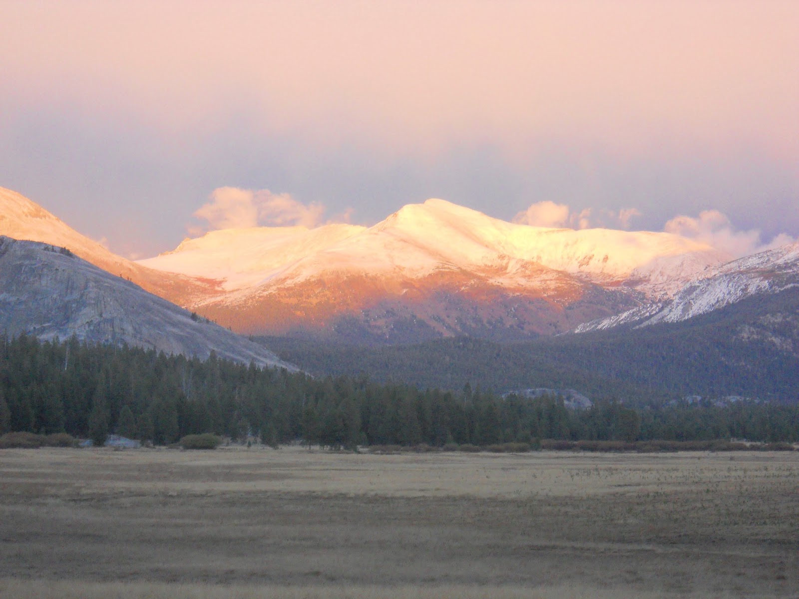
Tuolumne Meadows Tentative Opening

Tuolumne Meadows, Oct. 2012
taken pre-storm (we had to go to lower elevation to camp!)

I am torn between being excited that on May 11 Tioga Pass Road may open, or sad that it means we have very little snow pack.  I guess at this point I'll choose excited - time to plan the next Jaunt Adventure Group hike!

Playing on an iced over puddle near Olmstead Point

There are so many hikes that take off from Tioga Pass, and a few can be done early season, but there will be parts of the trails that are snow covered or muddy.  I'll get to planning in the next week, and have a back-up plan in case we get some weather and the road doesn't open.  Back-up plan will probably be Henry Cowell Redwoods or Big Basin, both coastal redwoods areas.

4 years ago; the meadow greens up nicely in spring & summer

So stay tuned in the next week as I research which hike we can do early spring.  For this one I may get us going further, and with the high elevation of this area, it may not be as kid friendly to take a trail, but kids love just walking along the river and playing in the meadow itself.  So as always, all will be welcome and there will be options.  


Thursday, April 4, 2013

Living Rancho History & Coastal Hiking


One of the many beaches along the Ohlone Bluff trail at Wilder Ranch State Park

On Sunday, April 14, we have the opportunity to hike along the bluffs of the Pacific Ocean, explore its many beaches, AND participate in a day of early California ranching history. Between 11:00 & 3:00 there will be many hands-on activities like butter churning, roping skills, wagon rides, and games like tug o' war and hoops. The kids will love this day at Wilder Ranch State Park! 

It's about a 2 hour drive and costs $10 cash to enter the State Park.  We'll first check out the ranching activities, then hike the flat trail along the bluffs which afford us spectacular views of the water, cliffs, and farm fields.  Along the trail we'll find a beach on which to picnic, allowing the kids to find the caves, and meander in some waves and get full of sand.  If you are along without kids and up for more of a workout, the trail CAN lead you on for 6 to 10 mile loop, but our kid group will go out and back for just a couple miles or so. Or if you're a runner, bring along those running shoes and get your run on, we can meet up later at a sandy cove. 


Quick History Lesson:
In 1791 this land became Rancho Matadero, started by the Santa Cruz Mission, and its purpose was to supply the mission with food.  The Wilder family operated it as a successful dairy for nearly 100 years, and in 1974 the California Department of Parks and Recreation took over.  The ranch's buildings, barn, gardens, and Victorian house still stand, and are open to the public. 


Sea Lions hang out and play and can be seen from a "secret" beach.

The park spreads along the east and west sides of Highway 1 and has more than 30 miles of hiking, biking, and horse trails.  We will hike the Ohlone Bluff Trail, which is flat and looks out to the ocean the whole time.  There are many spur trails going down to beaches that are perfect for exploring and having a picnic. 


 If you are interested in coming along, 
please send an email to Nicole at jauntwithus@gmail.com.

If you are already on the group email, you're in the know already, and I will send out the group email with meet-up details a week or so before.

(I never post the meet-up details on this public site - who knows what "strangers" could stumble upon it, so I do all that info. via email for safety.)


Monday, March 11, 2013

Mark Your Calendar: March 30


Time for the Next Hike!
Saturday March 30, 2013 (Easter weekend)
Red Hills, Chinese Camp (south of Jamestown)

Send an email to Nicole at 
jauntwithus@gmail.com 
to sign up.  
I'll add you to the group email list 
and email you the trip details the week before the Jaunt.
For this hike we will meet-up around 9:00 - a later start for those of you who couldn't make it so early for the February hike!  


Red Hills
My daughter, when she was 5, & her friend, when he was 3
Start 'em young!

This route at Red Hills is kid friendly because it isn't really long, about 3 miles, (more distance can easily be added for those who want it) and it is mostly flat.  Well, there is one steep hill at the beginning, but it is short.  From the top of it you have a nice view into the mountains.  The rest of the way is peppered with short rolling ups and downs, and lots of flats.  The trail is shared with horses and mountain bikers, and dogs are allowed. (Dogs should have rattlesnake vaccination to hike here.)


 If we get lucky and get some rainfall before the 30th, the creeks will be nice.  I've been there when they are completely dry.  Nothing feeds them except rainfall running off the  hills.  March and April are the best times to visit to see wildflowers, as later in the summer it gets HOT and DRY.  There are usually quail, chickadees, and other birds to see.  


As usual, bring the following in a day pack:  at least 1 liter (32oz) of water, snacks, sunscreen, hat with brim, layered clothing, comfortable shoes, and your camera.  Let's get out there and enjoy spring in the hills!  

Tuesday, February 12, 2013

Let's Go to Mt. Diablo!

Our family had a great time camping at Mt. Diablo State Park this weekend, and we are  geared to get you out hiking on February 23rd!

A huge Live Oak in Juniper Campground

To sign up to jaunt with us at Mt. Diablo on Feb. 23, send an email to Nicole at 
jauntwithus@gmail.com.
Then you'll get an email back with trip details, like the meeting place and time, and what to bring. 

The drive is less than 2 hours, and goes up the 680 freeway into Danville.  

A view from the summit (hiking along the Mary Bowerman Trail)

The view we had at night of the Bay Area city lights from our tent site was incredible,  but what we saw during the day from the summit was even better!  (This state park closes at sunset, so if you ever want to see the night view, you will have to camp.)

The wind had come up during the night, and continued as we explored the trails and summit the next day.  Our tents and down bags kept us and the kids plenty warm, but getting up for the day was another thing.  It was a cold morning!  It is common that down in the valley it is warmer and not windy, while up on the mountain it is colder and quite windy.  So if you jaunt with us here, wear layers and maybe gloves and a knit hat.

Vegetation around the mountain varies.
Here there are wild oats in the grasslands.

We explored 1 mile of the 2 mile trail that leaves Juniper Campground and goes all the way to the summit of Mt. Diablo.  It is all up hill, but never very steep.  Many spots along the way begin to offer peeks of what will be a panoramic on the summit.  The trail offers nice rest spots for snacks and photos.  


Summit Visitor's Center, built in 1939

People can hike to the summit, or drive there, and many ride their bikes up, too.  (The Amgen bicycle race will happen in Mt. Diablo in May again this year.)   You can park right by the Visitor's center.  We hung out inside for quite awhile since it was so warm and toasty in there!  It has a small shop, and the upstairs has a great place to learn about the geology, natural environment, and history of this unique place.  There's even a seating area with books to read, complete with an electric fireplace.  The observation deck is closed until later in the spring, but great views are available right in the parking lot.  

Another spectacular view from the 3,849 foot summit

We found stunning views on the Mary Bowerman Trail.  It starts in a lower parking lot, and has a trail guide with numbered markers that tell about what you see along the hike.  On this trail you literally walk around the summit, so by the time you are done you've seen a 360 degree view of the area.  It was a really clear day; we saw the Golden Gate and beyond, and even sighted Mt. Lassen way up north.   What's interesting is how the vegetation is different depending on what side of the mountain you're on.  When we got around 3/4 of the way it was so nice to soak up some sun and really warm up!  Where we had started the trail had ice on it!

After taking down camp, we headed back out to the South Gate, but made sure to stop at Rock City.  Rock City is amazing, but really disappointing because of all the damage people have done over the years.  Here are large sandstone rock formations that have been here for 50 million years, and there is a ton of permanent damage from people carving and even painting on them. So sad!  But the kids had fun climbing, finding "wind caves" to hide in, and just doing the exploring that kids like to do.  

One of many sandstone formations at Rock City

Options for Feb. 23 Jaunt:
1. Drive to the summit.  Explore the visitor's center.  Walk the Mary Bowerman Trail around the summit.  (Less than a mile walk, mostly flate.) 

2. Hike up 2 miles from Juniper Campground to the Summit.  Explore the visitor's center.  Possibly do the Mary Bowerman Trail around the summit (it is less than a mile).  Hike back down to Juniper, or drive down with someone in the group who chooses to drive to the top.  

3. Do option 1 or 2, then also hike over to North Peak, which would add just over another 2 miles to your day.  

There are many picnic spots tucked away
all through the park.